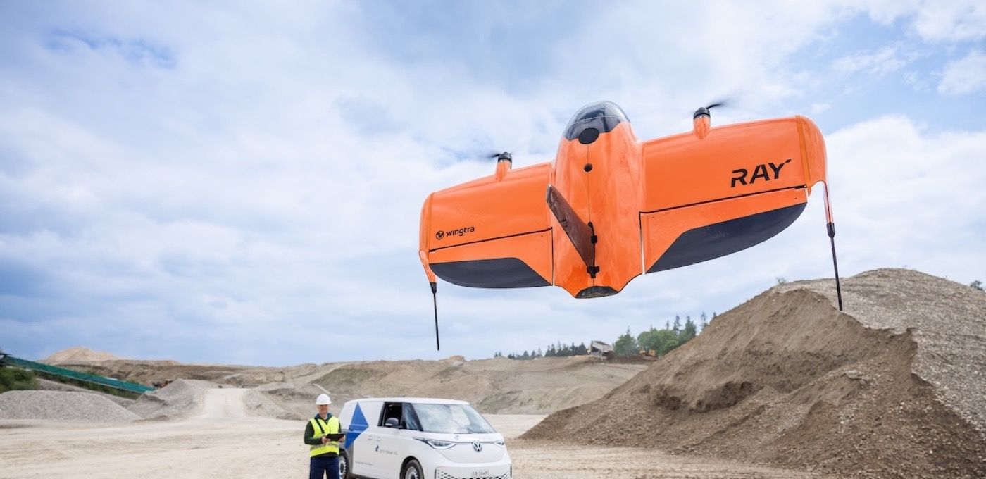
Take off vertically. Map on the wing.
Vertical takeoff and landing remove the need for a runway. Fixed-wing cruise supports efficient capture over large sites, corridors, and landscapes.

A fixed-wing VTOL mapping system for teams who need efficient aerial capture and a clear path from fieldwork to deliverables.
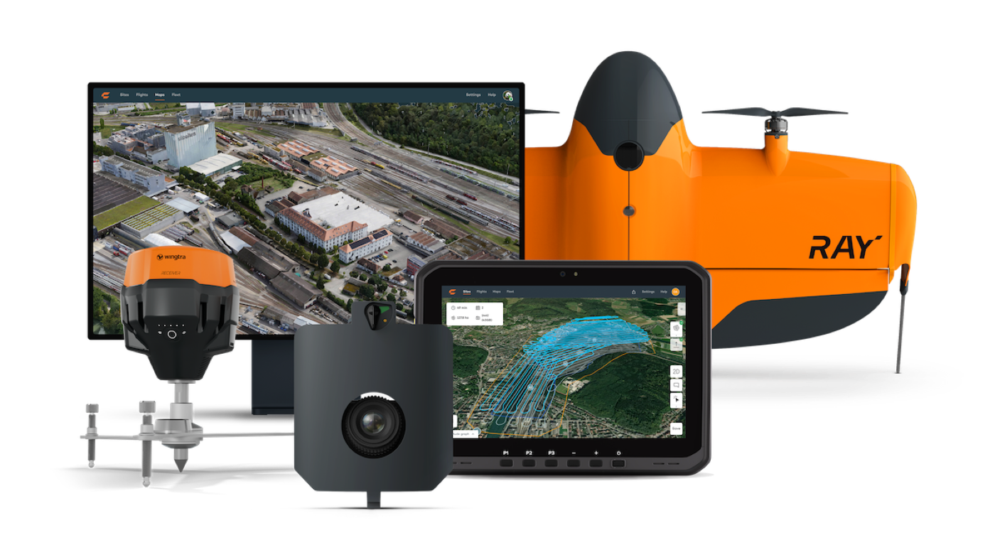
Flight time depends on sensor and conditions. MAP61 coverage is measured at 120 m above ground and 2.7 cm/pixel GSD. The 3 cm RMS x/y/z accuracy requires Wingtra’s recommended GNSS, correction, processing, and independent-checkpoint workflow; it is not a guarantee for every project.
We sell WingtraRAY systems now. We do not yet operate one in AerSol’s service fleet, but plan to acquire the same system for our mapping work. With the C40, we already have an aircraft for equipment walkthroughs and plan to use that same model for spraying. Our direction is simple: sell the systems we choose for our own work, and be transparent about what is available today.
Vertical takeoff and landing remove the need for a runway. Fixed-wing cruise supports efficient capture over large sites, corridors, and landscapes.
Adaptive speed adjusts between 16 and 22 m/s. Select the sensor, ground sample distance, overlap, and mission plan around the detail your project requires.
Guided preflight checks, mission planning, and GNSS correction workflows support consistent capture across construction, earthworks, mining, agriculture, and environmental monitoring.
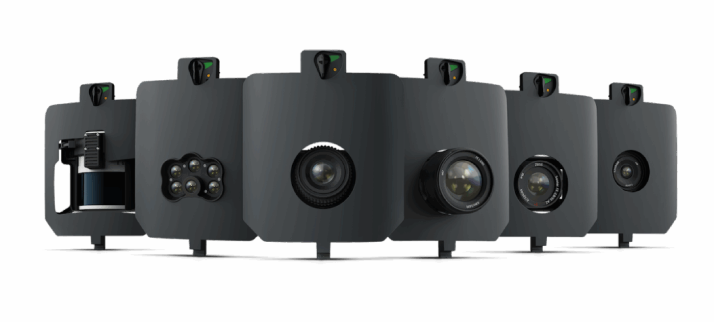
MAP61 uses a 61 MP full-frame sensor for high-resolution mapping. SURVEY61 supports survey-focused workflows; INSPECT supports detailed inspection capture.
Capture point clouds and terrain detail with the LiDAR payload. Published capability is up to 45 minutes and 1,140 acres at 120 m with 30% side overlap, depending on conditions.
MicaSense RedEdge-P supports vegetation and environmental analysis. Sensors, mounts, software, and processing requirements depend on the package you choose.
Plan your mission, complete field checks, capture the site, and geotag imagery with GNSS corrections. Process in Wingtra software or compatible tools such as Pix4D, Agisoft, or Trimble. Validate results against independent checkpoints before relying on final outputs.
Depending on sensor and processing, build orthomosaics, point clouds, digital surface models, and 3D representations. Export options include GeoTIFF, LAS, CSV, and geotagged imagery.
Discuss WingtraGROUND, your existing survey-grade GNSS base, or other correction methods. LiDAR uses its own processing workflow. Software subscriptions and optional processing are confirmed in your quote.
Professional surveying deliverables require the appropriate scope, qualifications, and review. Buying this system does not itself establish survey accuracy or professional authority.
We quote the aircraft, selected sensors, batteries, charging, controller, GNSS equipment, software, and accessories as an itemized package. We work with different lenders to explore financing, subject to their approval and terms.
We confirm onboarding, learning support, warranty terms, service arrangements, and optional WingtraCARE coverage before you commit. Availability and package contents are confirmed in your proposal.
Discuss the optional parachute and the requirements that apply to your missions. Flight permissions depend on aircraft configuration, location, pilot qualifications, and operating rules. We do not currently offer AerSol WingtraRAY flight demonstrations.
Technical reference: WingtraRAY specifications and configuration details ↗